
Remote sensing has made huge breakthroughs in recent years in providing global maps of land cover and land use. A typical example is Dynamic World Map, a near-real time land cover dataset released in 2022 (see image below). It provides 9 primary classifications of land cover, including water, trees, crops, etc. However, pixel values alone cannot reveal what is going on under the canopy? If a water pump is working? Or what are the incomes generated by fields? To answer such questions, we need to map the Earth from the ground up.
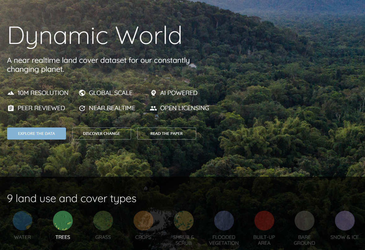
Dynamic World Map is powered by Google Earth Engine to process petabytes of Earth observation data. There is always more and more data and more and more computational power. It is well known that data science can help tech companies grow and improve. However, how can data science be used to solve socio-environmental pressing issues?
In the last ten years, the UCL ExCiteS team has adapted and co-designed data collection tools for people with limited resources and low technical literacy. These tools are used by farmers, agro-pastoralists, fishermen, or indigenous people in 21 case studies in 12 countries in the Global South. In each place, they share their knowledge of land use and land cover and provide high frequency ground-truth data for numerous secondary classifications. Thus, we can tell where the elephants are in the rainforests (see image below), but also if a water pond is for animal or agriculture in drylands (see image below), or how much money a field is making for its farmer in arable lands. The good news is that if it can happen in these critical environments, where there is little or no electricity or network, it can happen anywhere.


Combining mapping from space and its primary classifications with mapping from the ground up and its (potentially infinite) secondary classifications has the potential to revolutionise the decision-making of governments, UN agencies, businesses, scientists and activists by generating maps with practical value to act on in the sectors of agriculture, conservation, crisis and natural disasters, supply chains, forestry, insurance, landscape restoration, science, and water.
Our vision is that climate change is starting and will increase. It becomes vital to reinforce our collective capacity to adapt to change. We believe that creating intelligent maps is one of the most effective ways to achieve this goal, as intelligent maps enable us to see the change and therefore to make better decisions. More importantly, by building these intelligent maps, we will develop the qualities of cooperation between the global north and the global south that are needed to save us all from climate change.


Acknowledgements: Thank you to the Geo for Good community. This project has received funding from the European Research Council (ERC) under the European Union’s Horizon 2020 research and innovation programme (Grant agreement No. 694767 and ERC-2015-AdG).
For further information please contact: f.moustard@ucl.ac.uk and marcos.moreu@ucl.ac.uk

1 Comment