
We, students, researchers, experience science day-to-day. We improve knowledge in our disciplines. We predict futures with climate change research. We provide better understandings of the world. However, our numbers, our practices, despite developing an increasing power for understanding the world, seem not to grasp the world’s complexity. Indeed, we predict an increase of global temperature about 2-4°C within a few decades; but do we feel it, concretely, in our lives as citizens? Is it felt at a local, community level? When we take transport, visit relatives or walk in the park? All too often, scientists and science appear to be separate from society. We joke of “the ivory tower”. Indeed, we often seem to produce only theory and disciplines although there is a deficiency of practice and interdisciplinarity to bridge the gap between science and citizens and thus face world’s complexity with collective and distributed intelligence.
What if science were capable of moving from theory to practice? from disciplines to cross-disciplines? and from a top-down to a bottom-up approach? What if science and society deployed themselves inside one single dynamic adventure, without a gap between natural and social sciences, or between expert and layperson? This interdisciplinarity is what the UCL Extreme Citizen Science research group is exploring through a practical project carried out with non-literate and low-literate peoples living in remote areas around the world. What we call “Extreme Citizen Science” can happen anywhere, anywhere where peoples want to tackle issue that they face. And science can empower them to do so. Henceforth, the question is not only how to enhance science, but also how to open it: how can we give all people access to science?
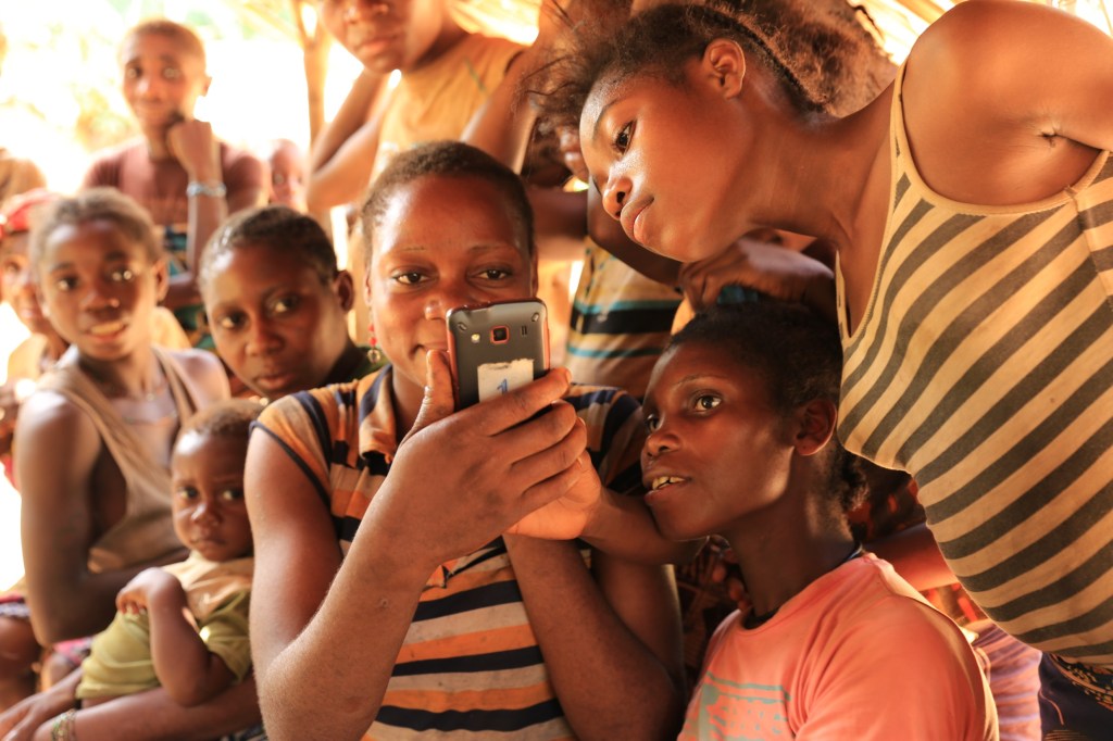
The ExCiteS research group takes into account that there is this little object that we have in our pockets, the smartphone, which reveals itself to be extremely relevant in order to address people’s challenges. With a well-designed mobile application, enough smartphones at once and their aggregated data might give rise to a collective intelligence flourishing into something concrete and useful, like a map. In eight fields around the world, an interdisciplinary alliance has formed between hunter-gatherers and geographers, farmers and anthropologists, computer scientists and others. Everyone is welcome, from academia and not, in developing an understanding of how mobile applications adapted and designed to challenges that people face could become a means of doing science. It is science by and for people, and is dedicated to bring the missing public back into science.
We’d like to tell you this story,
and we have put it into a StoryMap.*
*This StoryMap is also available in French.
